

71 snickelways: a micro-odyssey around the otherlanes of York
The most complete gazeteer of York's alleys, ginnels, snickets, courts and yards

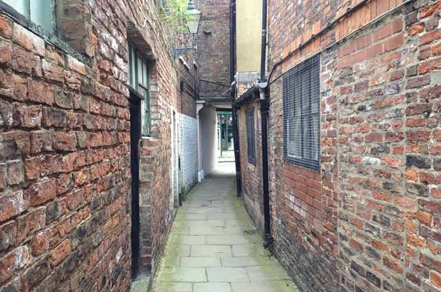
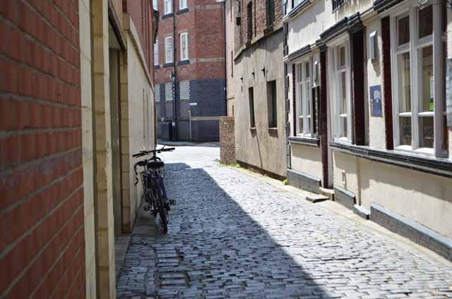
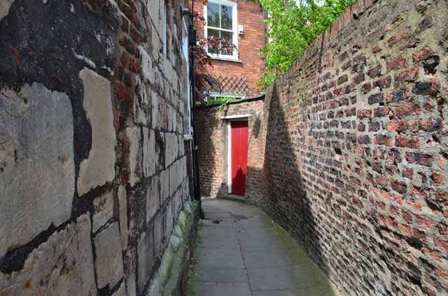
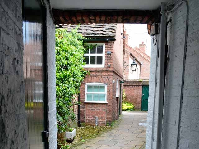
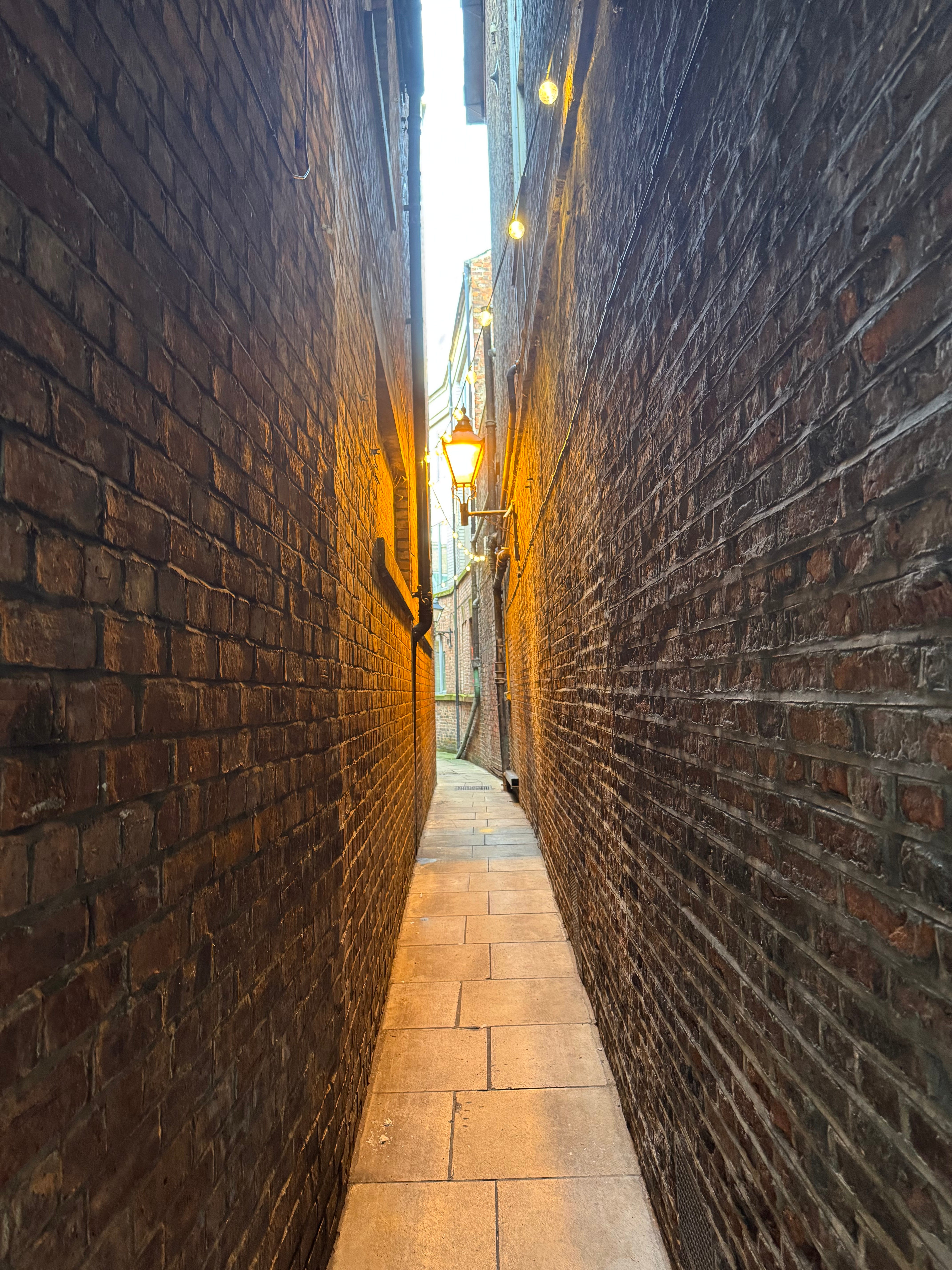
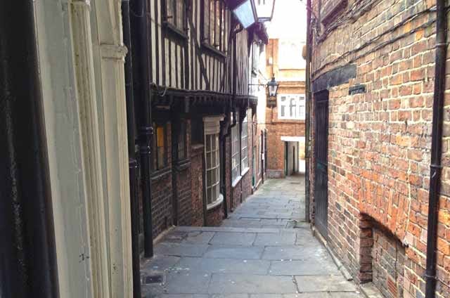
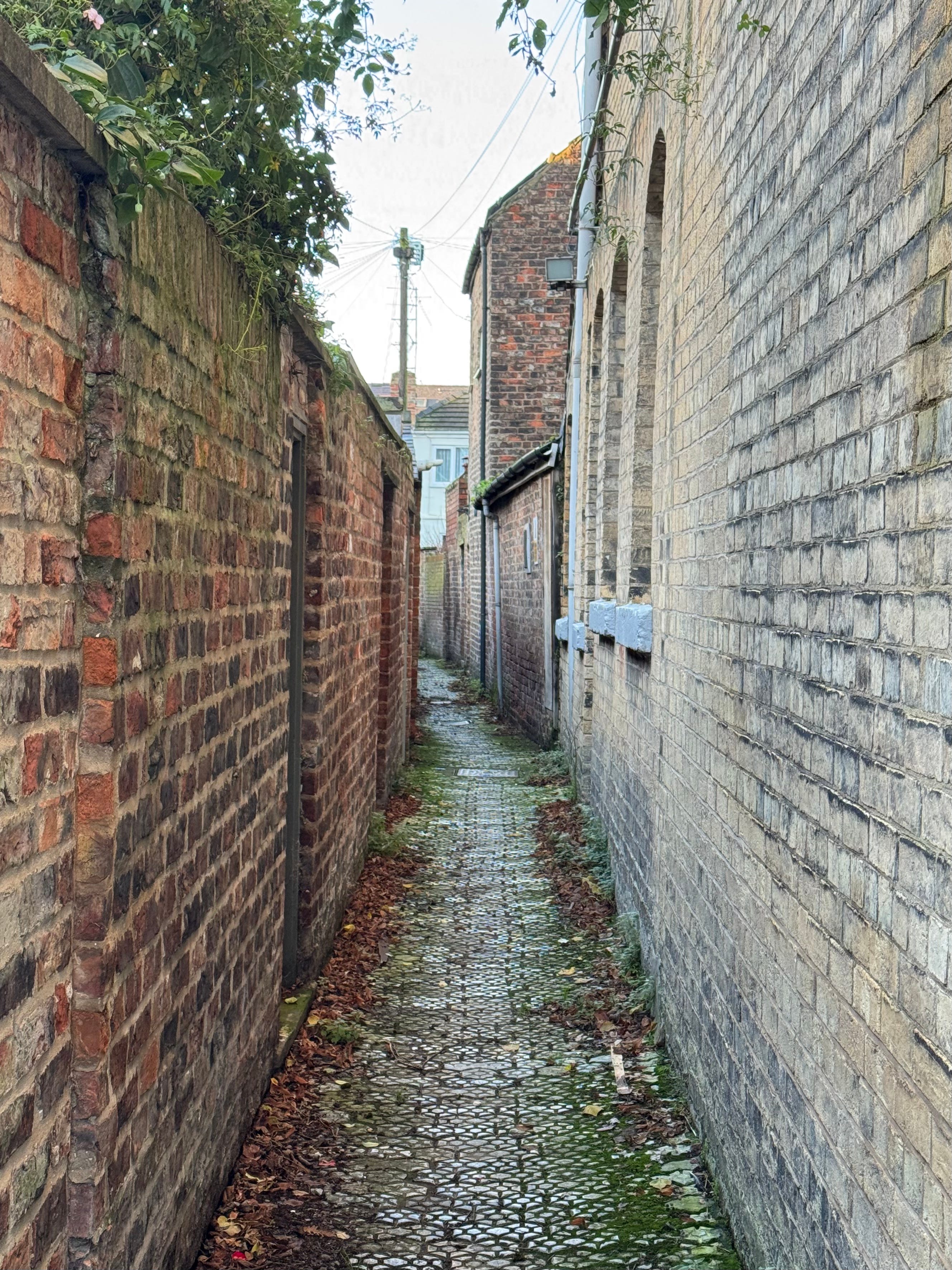
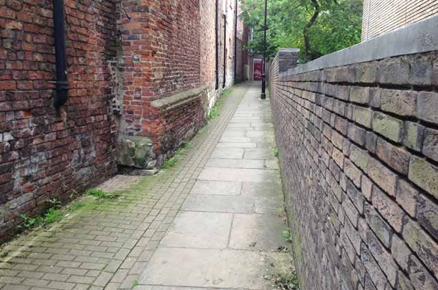
All cities have their secrets, but most are not so easily accessible as snickelways; the ancient alleys, ginnels, snickets and lanes that run between York’s streets. It’s in-between places.
A few are still used; many are not; some are largely forgotten. But all are places of stillness and retreat from the crowds; tunnels intersecting the dark roots of the city; rhizomes connecting place to place, resisting the city’s Disneyfication.
First coined by author Mark W. Jones in 1983, his specific definition of a snickelway is:
A narrow place to walk along, leading from somewhere to somewhere else, usually in a town or city, especially in the city of York.
They are the labyrinthine side effect of nearly 2,000 years of organic, unmanaged urban development, their density and eccentricity reflecting how York grew from a Roman fortress into a congested medieval commercial centre. The term ‘snickelway’ is a riff on ‘snicket’ - a small, narrow, winding path between walls. Its origins probably lie in the Middle English word snycke (a notch or cut), describing a narrow ‘nick’ between other structures.
Looking at their history and development, the Roman legionary fortress (founded c. AD 71) had a rigid grid of streets, but outside the fortress, settlement grew in a looser, more irregular pattern. Early lanes often followed property boundaries, drainage lines, and trackways. Eoforwīc and Jorvik’s emergence as a major trading hub created market plots (burgages) with long, narrow properties running back from the main streets. Each plot needed side or rear access for goods, workshops, and waste disposal, which evolved into narrow alleys. Those burgage plots and tenements developed into the medieval era. York’s wealth created demand for housing and workshops in tiny leftover spaces, meaning buildings often encroached on lanes, narrowing them further. Courts and yards were inserted in backlands, accessible only through tight, tunnel-like passages. These service lanes then became fixed as property boundaries were enshrined in law, and acquired names.
In many cities, slum clearance swept away medieval alleys, but that did not happen in York, for various reasons: firstly, in the 18th century York was comparatively poor, so there was little incentive for redevelopment; preservationists and antiquarians were already championing York’s medieval fabric, resisting change; the Minster and ecclesiastical landholders owned large areas and resisted wholesale alteration; and many alleys served as convenient shortcuts and commercial access, keeping them functional.
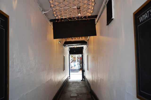
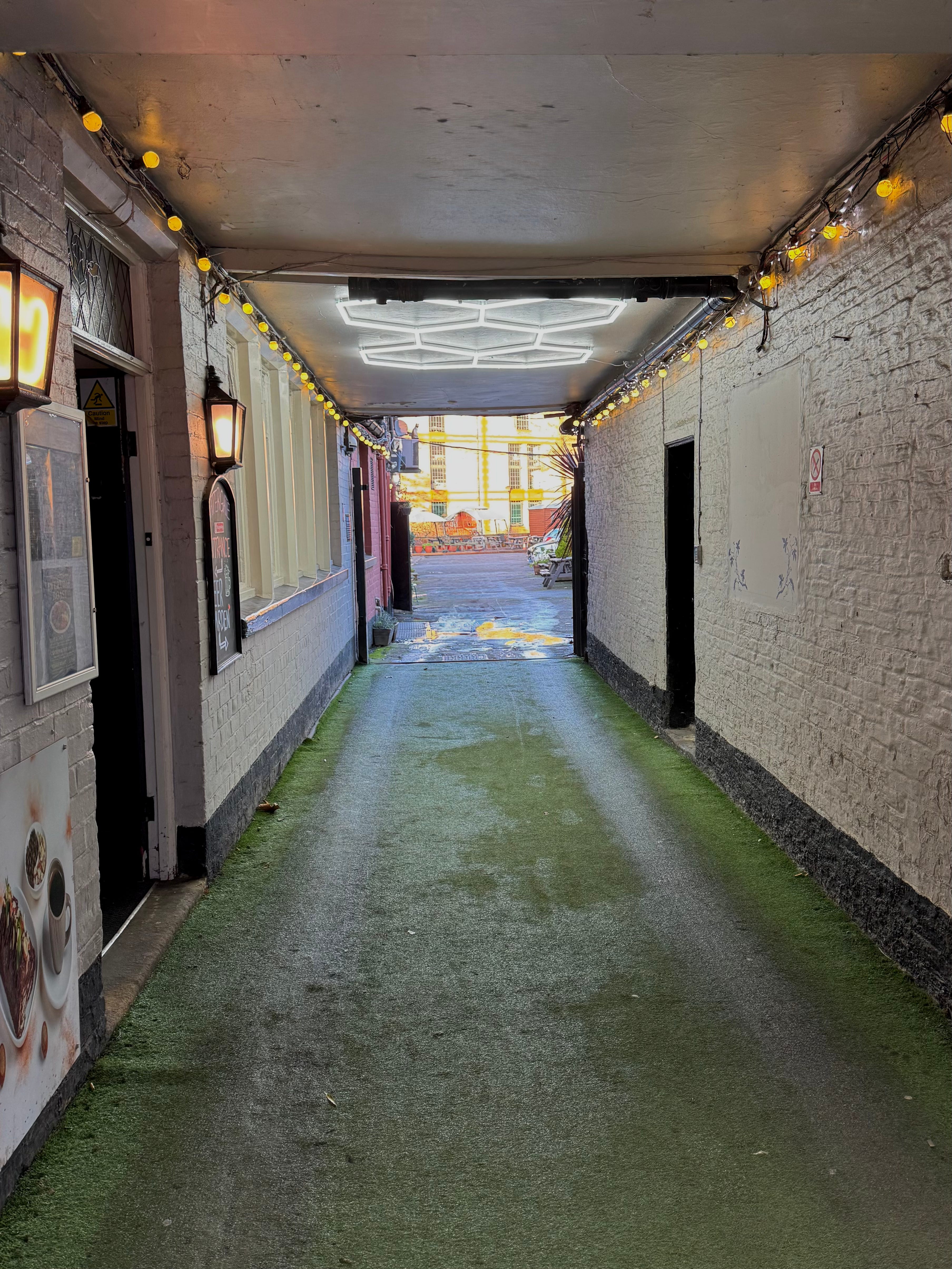
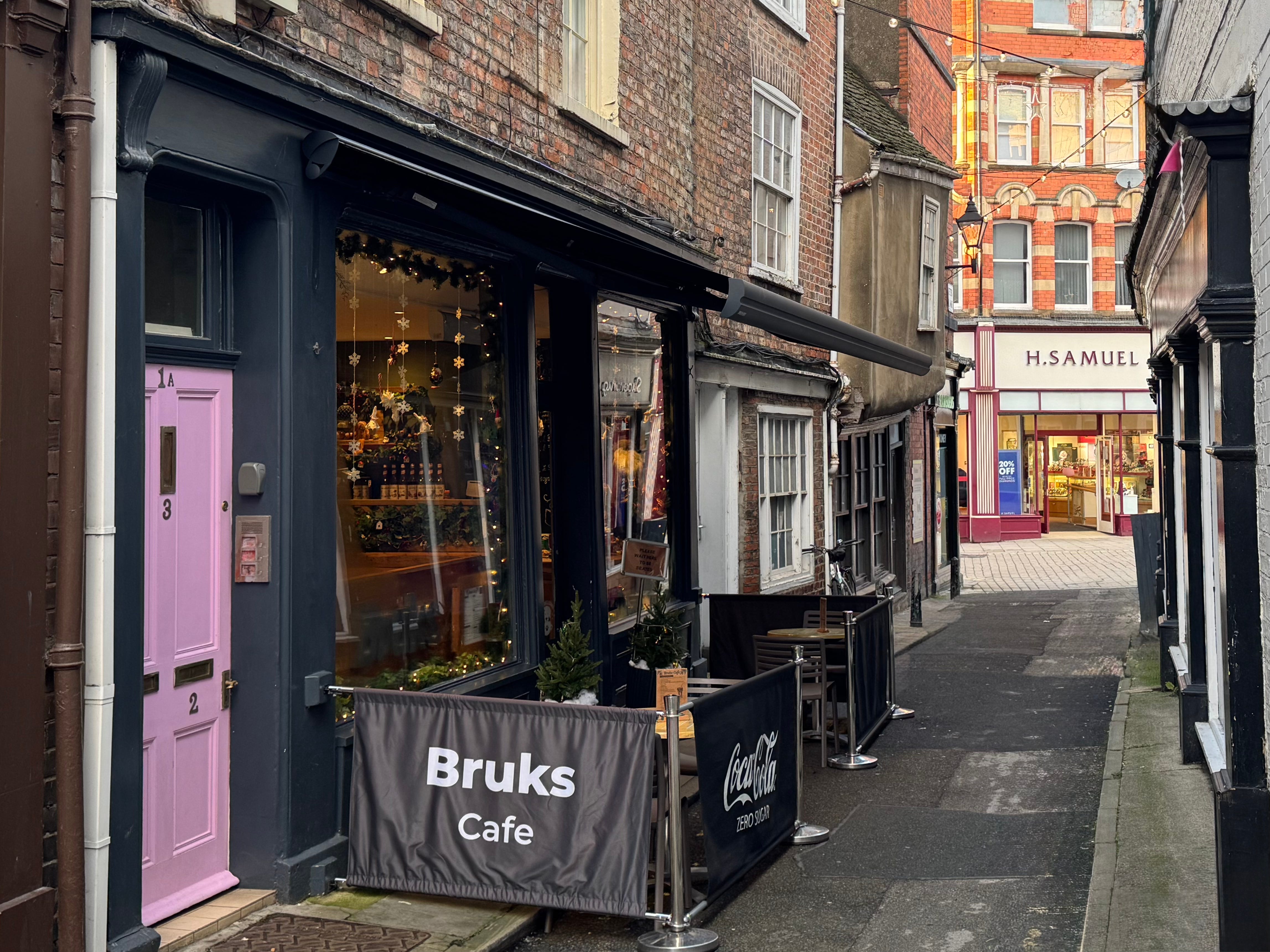
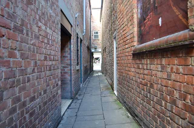
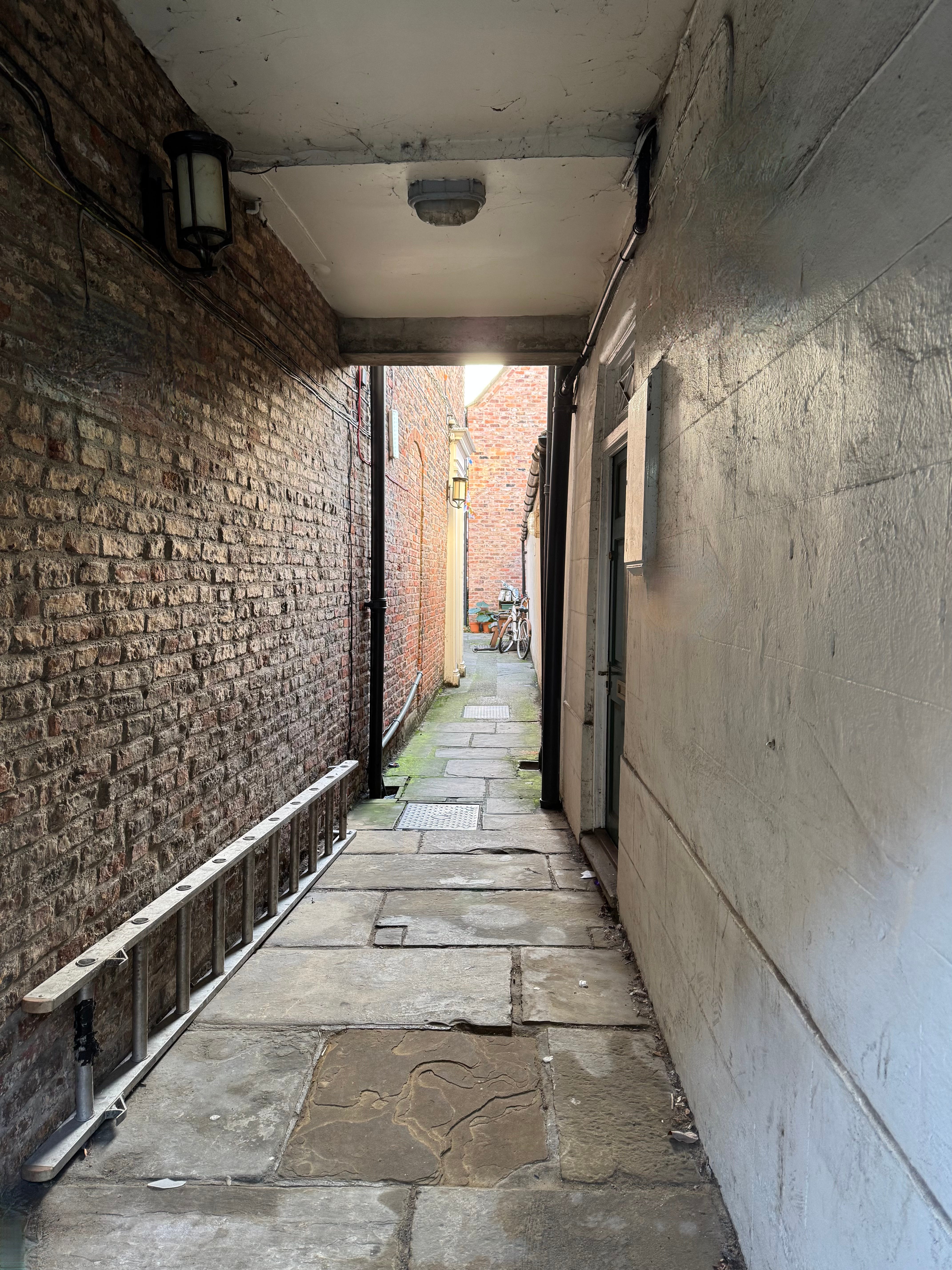
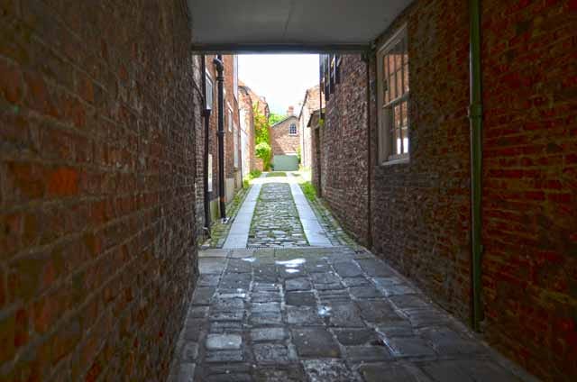
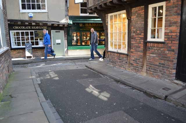
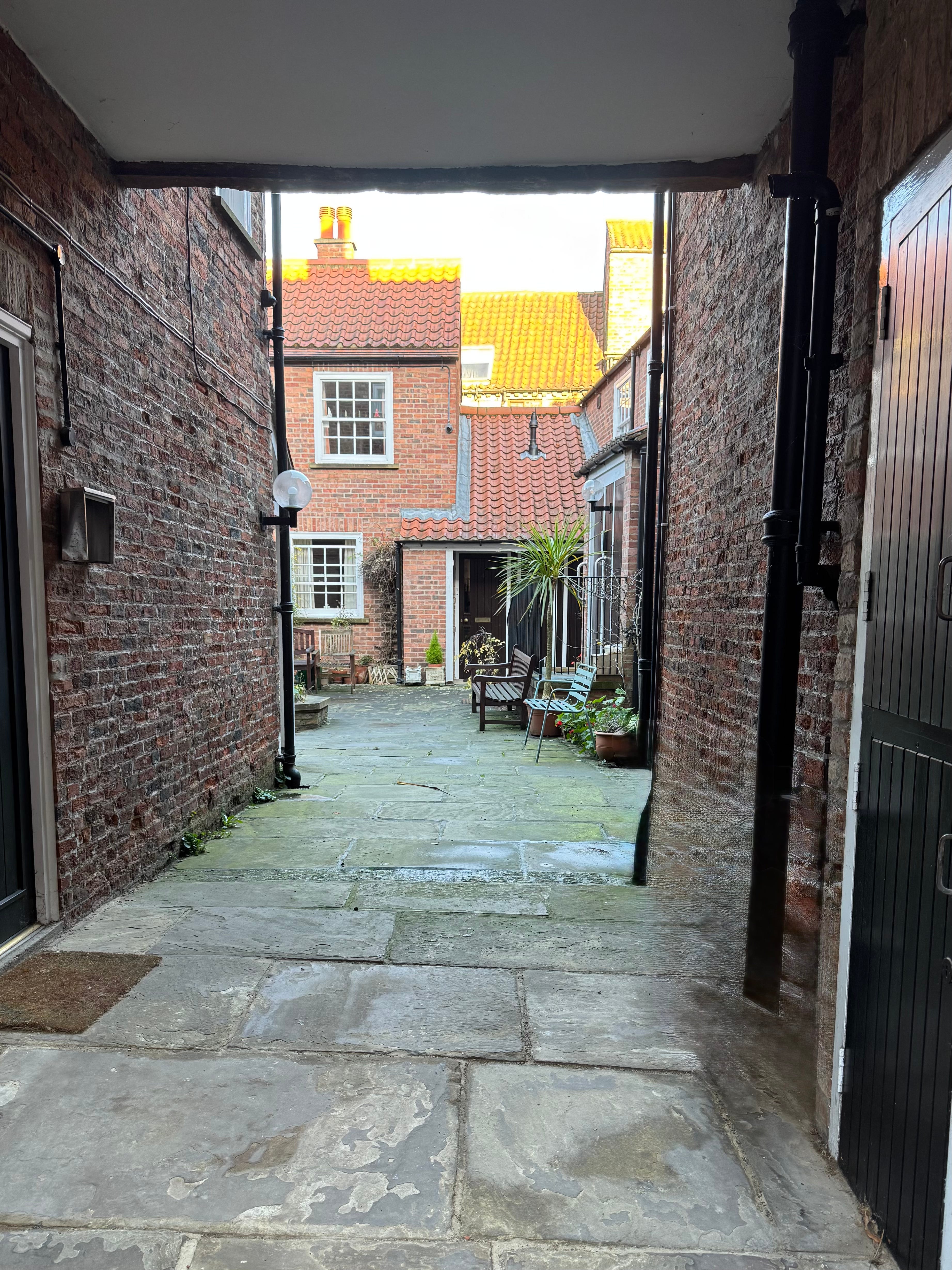
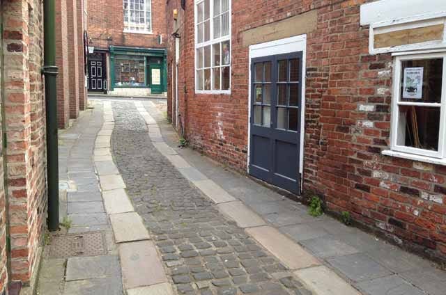
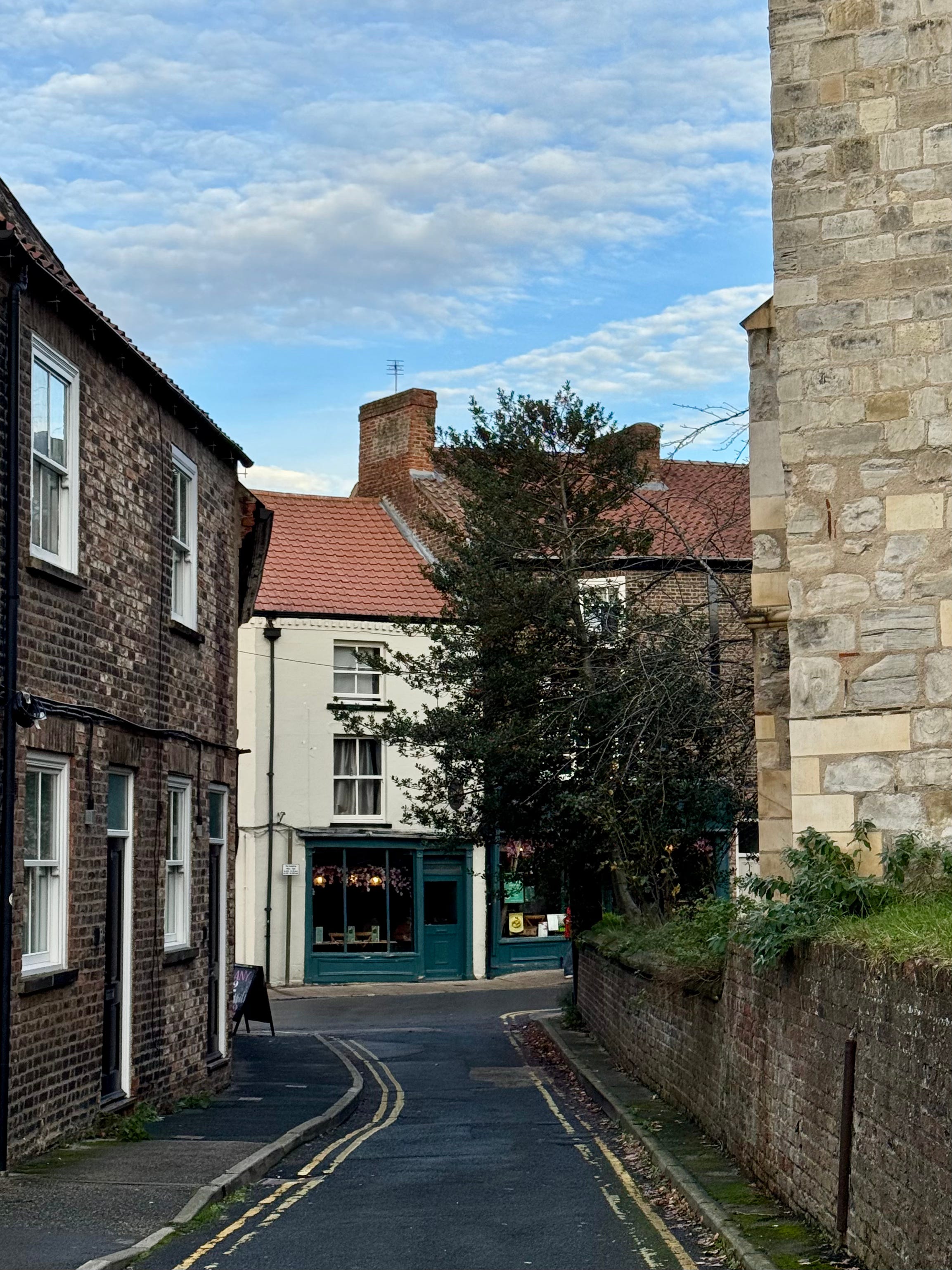
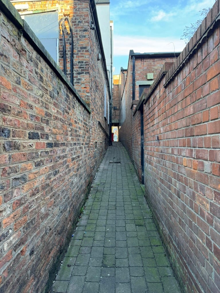
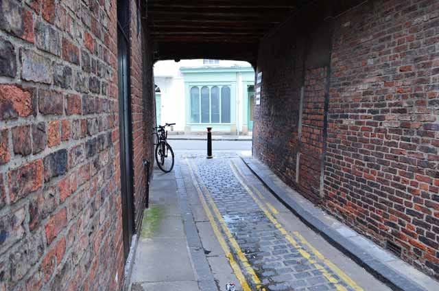
There’s some debate as to whether certain routes qualify as snickelways or not. Some, such as Friargate and Carr’s Lane, are just wide enough to drive a modern vehicle down. Others, like the Hole in the Wall, are so short as to be little more than an archway. Some provide useful shortcuts between different part of the city, others are cul-de-sacs. This selection is based on my own research and is pretty comprehensive.1 It includes a few controversial choices, and I’ve expanded the ‘snickelway’ definition to include yards and courts.2
What is particularly interesting is the fact that new snickelways continue to emerge, often as the result of new construction or the redevelopment of buildings within existing yards and courts.
Ye Olde Starre Inne
A snickelway off Stonegate opens into the courtyard of Ye Olde Starre Inne. Believed to be the oldest licensed premises in the York, it consists of a 17th century building sitting on a 10th century cellar. The pub is accessed via a short snickelway, and is allegedly haunted by a pair of black cats.
Phantom black cats have been seen and heard in this ancient pub, along with the cries of wounded Civil War soldiers; the pub’s cellar was used as a makeshift hospital at the time.
Watergate Inn
This alley beside the Waterside Inn pub was originally a carriageway, providing access to stabling in the courtyard beside the River Foss. First recorded as the City Arms in 1702, this coaching inn was later renamed The Five Lions in 1818. It regularly ran coaches to Wheldrake and Full Sutton. Modified over centuries, its tiled front was added in the 1930s. The building is now Grade II listed.
‘Trembling Madness Court’


Beside the House of the Trembling Madness on Lendal is an unnamed alley leading to a new riverside office complex.
Three Cranes Lane
Located next to the pub of the same name, this snickelway was once a busy thoroughfare to the market held at St Samson’s Square.
‘The Norman House Snickelway’
Often locked, this alley off Stonegate leads to a courtyard in which the ruins of the Norman House are to be found. The ruins of the house, built 1170-1180, are the only remaining example in York of Norman domestic stonework that survives in its original location.
Talbot Court
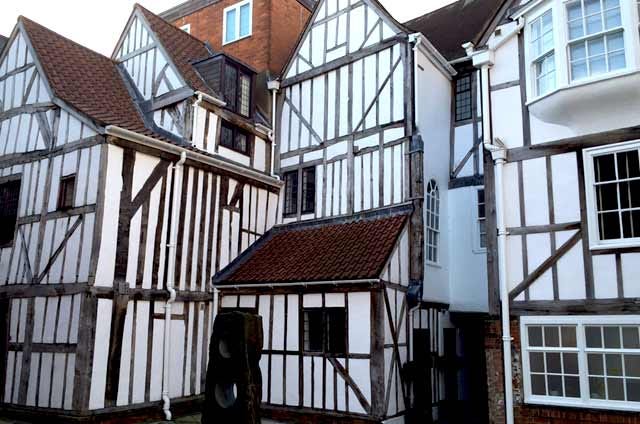
Talbot Court is a gated courtyard off Low Petergate. Access is flanked on one side by 62 Low Petergate, currently a restaurant but previously York College for Girls. On the other side is a row of shops with modern facades. But once inside Talbot Court, the true nature of the building housing these shops is revealed – an impressive, complex, period timber-framed structure. Some nicely-carved wood vines are also visible to the left of the entrance.
The courtyard also reveals stunning views towards the Minster, and interesting perspectives on both Holy Trinity Church Goodramgate, and buildings of the Minster School, founded in 627A.D. by Paulinus, the first Archbishop of York, and now a restaurant.
Swinegate Court East
This is a relatively modern L-shaped narrow courtyard is mainly populated by bars and restaurants, linking Swinegate (from ‘Swinegail’ meaning the ‘lane where swine were kept’) and Grape Lane.
Straker’s Passage
Named after the family Straker who lived close and linking Fossgate with Garden Place. The York’s Chartist Association Room was located here. The Chartists campaigned for reform in England, based on a six-point charter, which demanded: secret ballots, universal male suffrage, equal electoral districts, payment for MPs, that MPs did not require to be property owners, and annual elections.
Stonegate Yard
Originally a three-storey Georgian townhouse and now a restaurant, its entrance is accessed via a snicket, running from Little Stonegate, to what is now a covered courtyard.
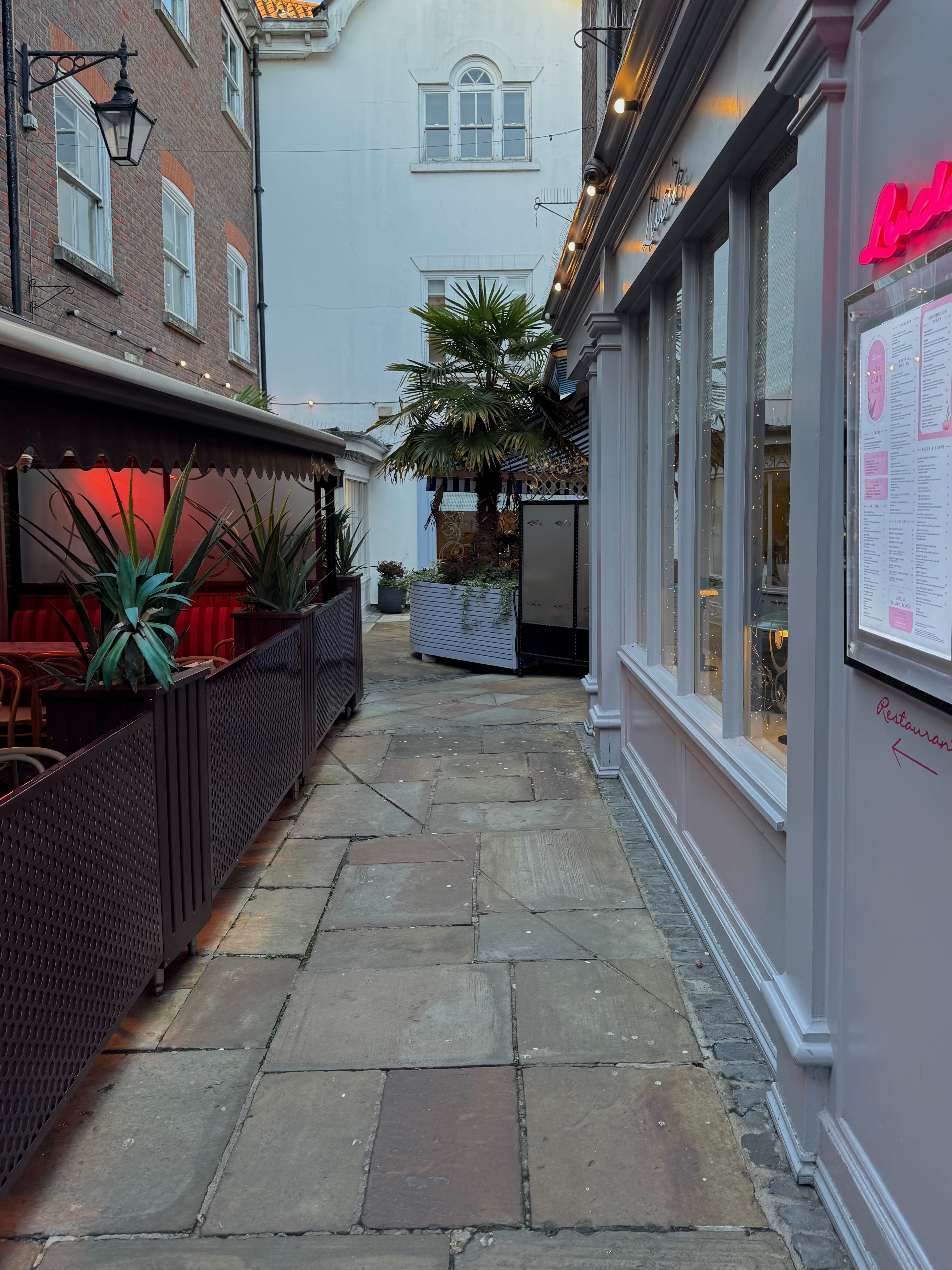
‘Star Inn the City courtyard’


The building housing this restaurant was originally constructed to accommodate a waterworks pump engine, built by civil engineer Joseph Smeaton in 1784, who was also responsible for the famous Eddystone Lighthouse in Cornwall. The engine was removed to new works at Acomb Landing c1850 after which the engine house was converted to office use. In 1983 the Old Engine House was granted Grade II listed status. Despite that, it fell into disuse and dereliction until, in Spring 2013 work began on renovating and extending it into the existing restaurant.
The archway and short alley provides a route through the walls of St Mary’s abbey, connecting the pump house courtyard with the cobbled route (technically an extension of Lendal) leading down to what is now Dame Judi Dench Walk.
St Martin’s Lane
This lane passes the Ackhorne pub and connects the church of St Martin cum Gregory, Mickelgate with St Mary Church, Bishophill Junior. Prior to 1618 it was known as West Church Lane, and primarily consisted of warehouses.
St Crux Passage

A short alley, named after the church it abuts, connects Whipmawhopmagate to the bottom of the Shambles. The Shambles is known for the number of butchers that used to trade from it. Shambles takes its name from ‘shammels’, an Anglo-Saxon word relating to the flesh benches or wooden sills outside the shops where meat was laid out. The street is mentioned in Domesday Book from 1086.
The headless ghost of Thomas Percy that haunts Holy Trinity church has been spied staggering down the Shambles, still searching for his head.
Spen Lane
This short alleyway passes behind St Andrew’s Church, connecting St Saviourgate with St Andrewgate. Dating back to the late 12th century when it was known as ‘Ispingall’, possibly from the Old English for ‘aspen trees’, it became the home of prominent Jewish financier Benedict the Jew around 1190, before his death following anti-Jewish riots in London. The area later saw the construction and demolition of a small house of the Friars of the Sack in the 13th and early 14th centuries and has had a mix of residential and other uses, including a Spiritualist church in the early 20th century
‘Shambles thoroughfares’


In addition to Little Shambles, three other thoroughfares connect the Shambles to Newgate market beyond. One is located directly beside the building housing the Shrine of St Margaret Clitherow.
Scala Yard
The Electric Cinema was the first purpose-built cinema in York (now ‘Cosy Club’.) Its rear service areas were underused and dilapidated until their transformation into newbuild dwellings by DLA Architects. This new yard on Fossgate is gated, but the properties beyond can be seen from the street.
Powell’s Yard
A snickelway next to the inn of the same name, it runs from Goodramgate to private residences and shops.
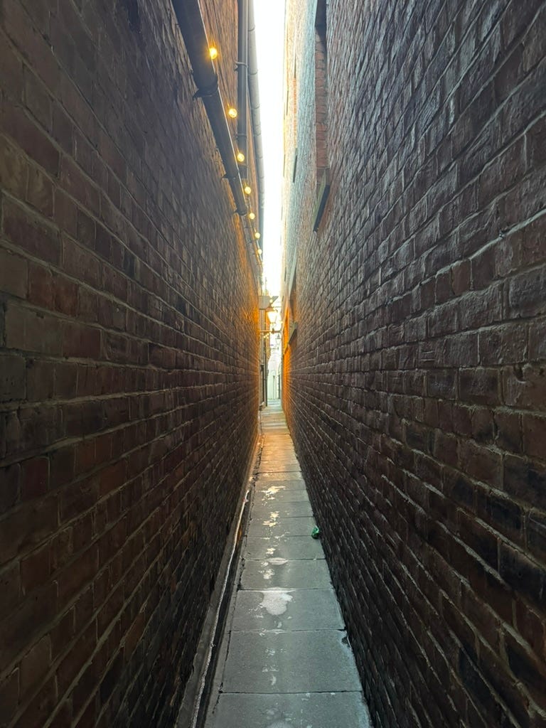
Pope’s Head Alley
Connecting Peter Lane with High Ousegate, at 2ft 7in wide it is York’s narrowest snickelway. Its name may derive from a tavern, no longer extant. However, a Crossed Keys pub was located in the parish in 1787.
Peter Lane
Along with Pope’s Head Alley and Le Kirk Lane, Peter Lane forms a network of Snickelways between Market Street and High Ousegate. Its name comes from the now lost St Peter the Little Church. These three entrances to the churchyard were used as thoroughfares between the markets at Pavement and Thursday Market (St Sampson’s Square.) Over time, buildings were constructed on the periphery of the church’s ground and the church was demolished.
The medieval home of one Richard Warry can still be found at the far end of Peter Lane.
Paver Lane
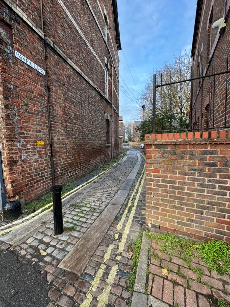
Originally known as Paviour Lane, archaeological digs nearby at 118-126 Walmgate have found evidence of Anglo-Scandinavian dumps, pits, and surfaces. There is also evidence of textile working, such as bone tools and spindle whorls. Paver Lane runs beside the National Centre for Early Music (St Margaret’s church) and connects Walmgate with Percy’s Lane.
‘Park Inn walk’
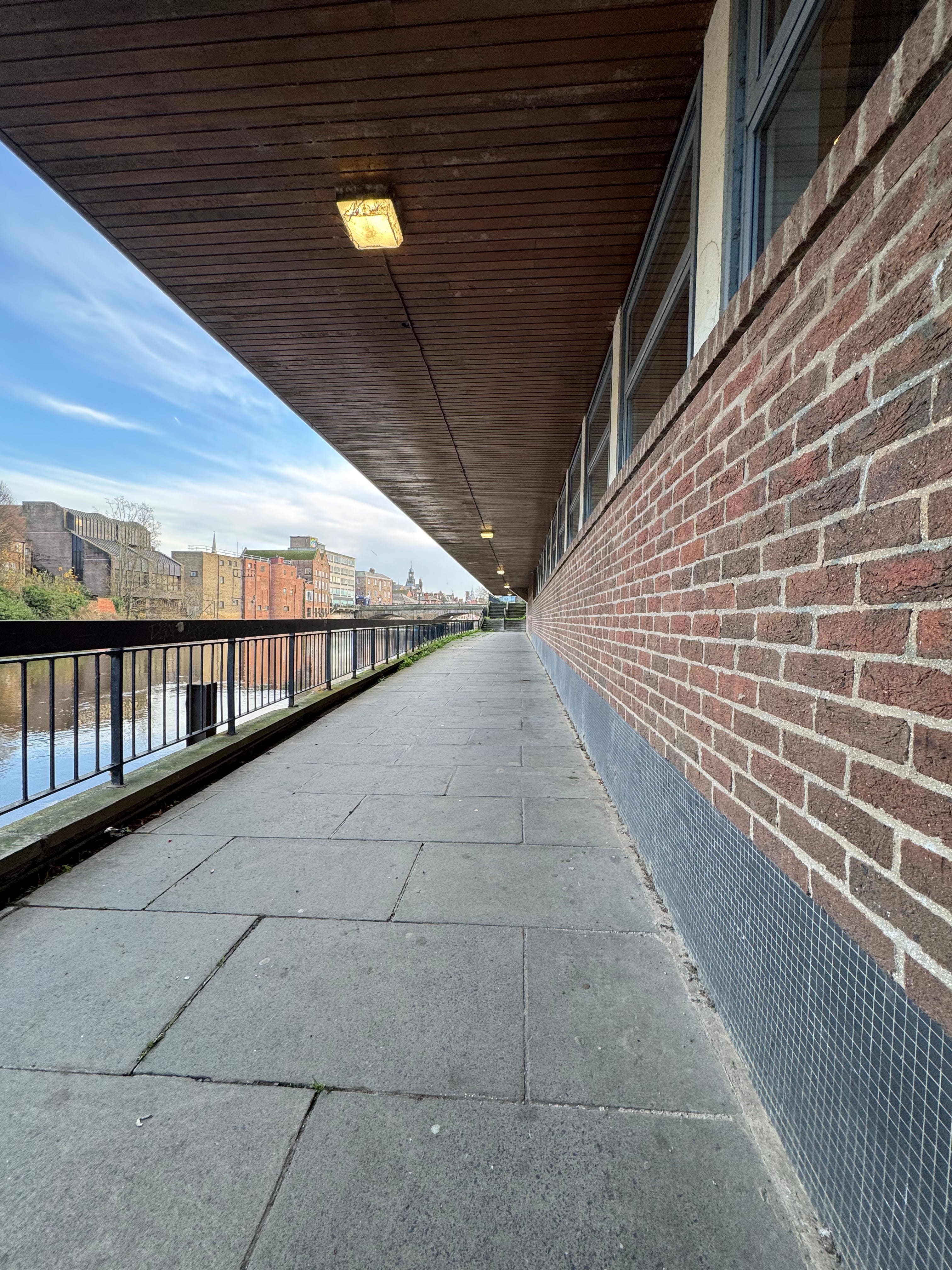
A public walkway along the River Ouse (currently inaccessible) from the park at North Street to Bridge Street runs beneath the cantilevered section of the Radisson Park Inn. This ten-storey modernist purpose-built hotel was opened in 1969 as the ‘Viking Hotel’. Its visual dissonance with York’s historic skyline means the edifice is generally disliked by almost everyone. Pevsner called it ‘intrusive’.
Nether Hornpot Lane
The name relates to the area of York in which its medieval horn-making industry was based – approximately behind Swinegate to Petergate. The lane’s name likely comes from the presence of ‘pots’ for soaking horn and was first recorded in 1295. The area was historically a craft quarter with metalworkers and leather workers as well, but the horn-making was a prominent feature, with evidence of hornworkers’ pits found in archaeological excavations. The area was a dangerous part of the city, full of fumes from furnances and retting pits, all amidst a tight complex of flammable timber buildings.
Morrell Yard
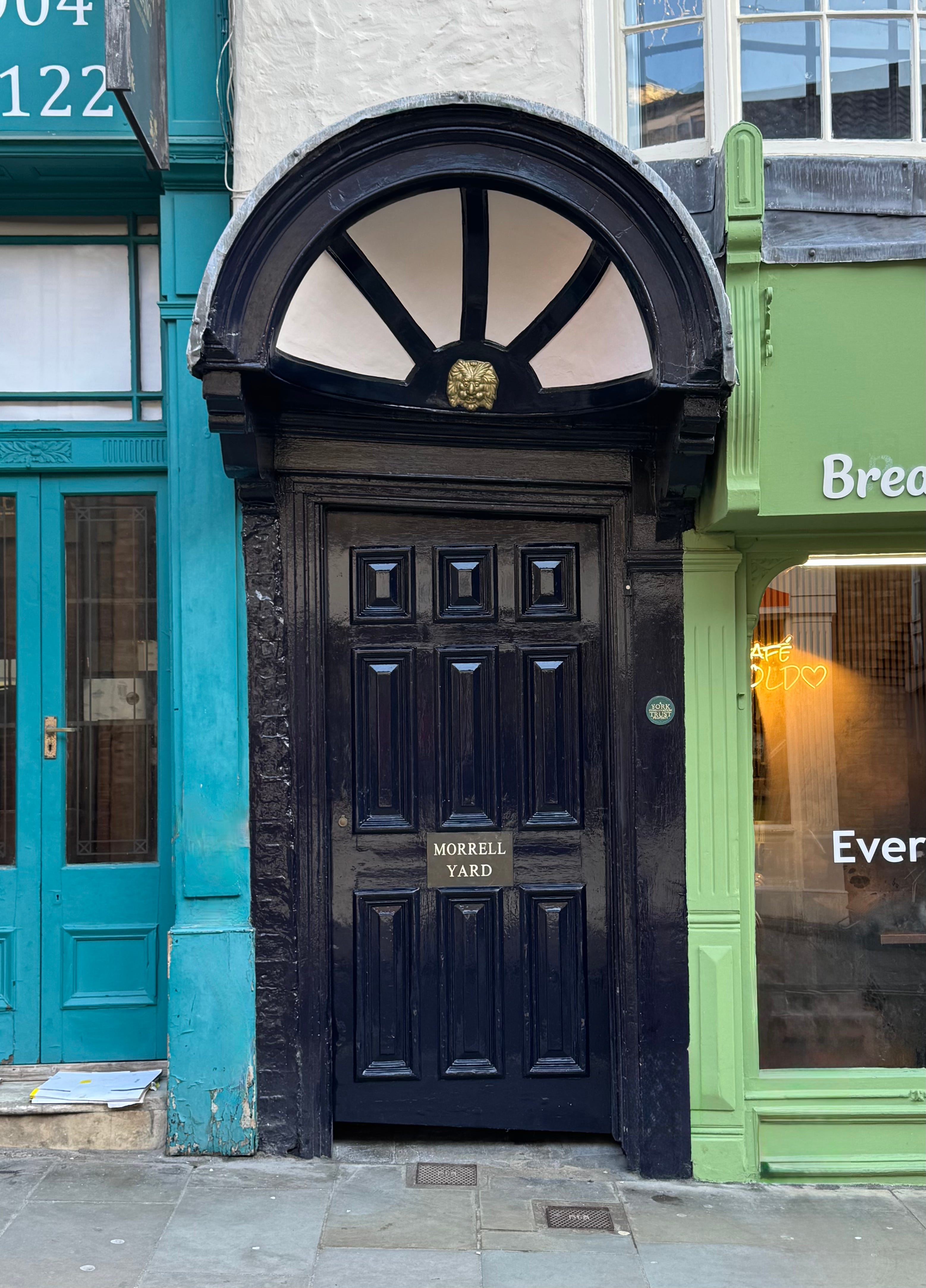
Early maps suggest what is now Morrell Yard, on Fossgate, once connected to the site of a Carmelite Friary and to a quay on the banks of the river Foss. Owned by York Conservation Trust, a mix of different buildings were converted into ten modern homes in 1999. Inside the Yard is a medieval well, said to be some 16 metres deep, not yet excavated.
Morrell Cottages
This is a gated snicket leading to a pair of cottages at 15b & 15c Walmgate.
Monk Bar Court
This snickelway is a cul-de-sac, accessible from Goodramgate, just before Monk Bar. It leads to a series of private dwellings. Originally known as Elbow Lane, it was the site of the ward’s midden, which was also the garden of one Thomas Barker, who lived there in 1575.
Merchant’s Hall
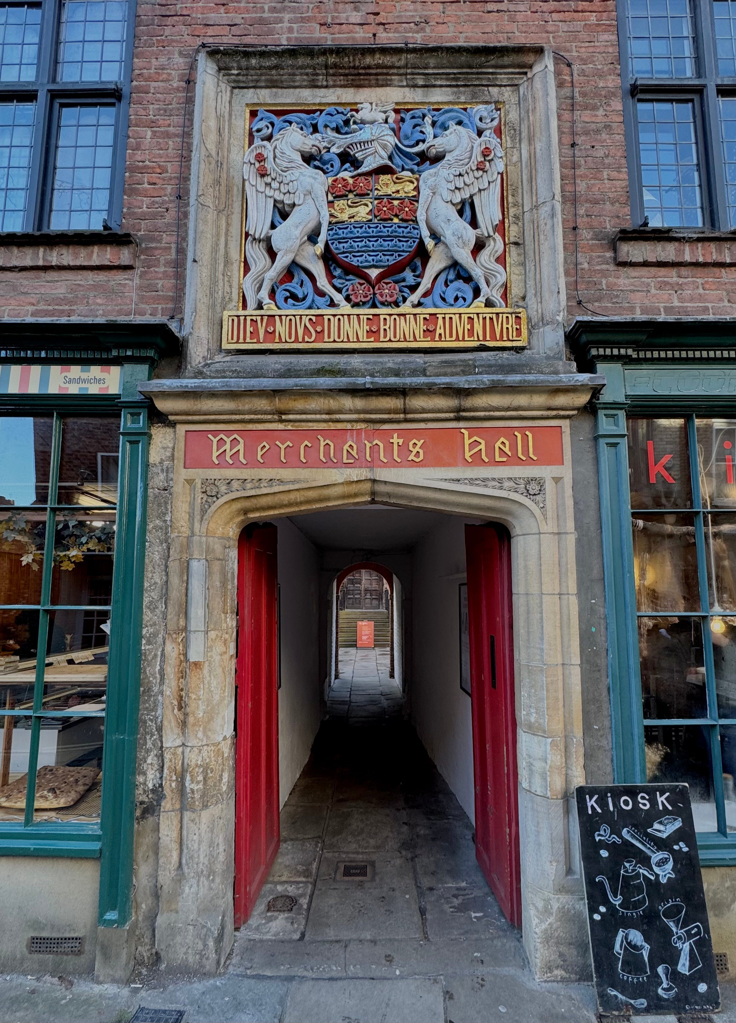
A short alley runs from Fossgate to the precincts of the Merchant Adventurers’ Hall. Bearing the guild’s coat of arms, the motto reads Dieu Nous Donne Bonne Adventure which translates as ‘May God Prosper Our Affairs.’
Melrose’s Yard


Melrose’s Yard on Walmgate leads to car parking, offices and residences. A York civic trust plaque notes that ‘The York Irish community settled in Walmgate and surrounding area from the 1840s having escaped The Famine.’
Marygate Lane
The near end of Marygate lane is now bollarded, but would likely be too narrow to accommodate a modern 4x4 regardless.
Lund’s Court (formerly Mad Alice Lane)
Mad Alice haunts this snickelway. Beaten remorselessly by her husband, she finally attacked and killed him. The murder caused her to go insane, and she was hanged at York Castle in 1825. A different story claims she was a 19th century prostitute who went mad after contracting syphilis. Her face can sometimes be spotted at one of the windows looking down over the lane.
There is a possibility that the name refers to an Alice Flokton, married to John Smith at St Michael Le Belfrey on August 24 1816. There is no register of any “Smith” - male or female - being detained at either York Prison (Bishophill at this time) or at the Castle Prison (the county prison).
‘Lower Friargate snickelway’
Besides the Friargate Theatre, a snickelway opens into a courtyard which, in turn, connects to Cumberland Street.
Little Shambles
This short lane links the Shambles with Newgate Market.
Lendal Cellars


Lendal Cellars partially occupies the site of York’s Augustinian Friary, once renowned for its extensive library. The Lendal Cellars pub is formed from the friary’s cellars and still contains a section of original wall. The snicket leads from St Helen’s Square down to the pub entrance, and on to a separate restaurant at the rear, towards the River Ouse.
Le Kyrk Lane
This snickelway runs parallel to Pope’s Head Alley, part of the parish of St Peter the Little. ‘Kyrk’ (or kirk) is a name and term of Old Norse (kirkja) and Northern English / Scottish origin meaning ‘church’ or ‘house of worship.’
Lady Peckett’s Yard
Connecting Pavement and Fossgate, the snickelway is named after then wife of John Peckett, Lord Mayor of York in 1701. Essentially two lanes in one, their earlier names may have been Bacus Gail, meaning Bakehouse Lane, and Trichour Gail, meaning Cheat’s Lane.
‘King’s Manor Snickelway’
A long snickelway runs along the side of King’s Manor, connecting the Museum Gardens with St Leonard’s Place.
John Saville Court
Situated in Ogleforth, John Saville Court includes a pair of houses from c1840 with earlier origins, and consists of eleven Almshouses. Renovated in 1985, it’s named after a third generation pharmacist at 7 Goodramgate, who was involved in several local philanthropic organisations. One of his daughters married Sir Donald Barron, a Chairman of Rowntree & Co.
Judge’s Court
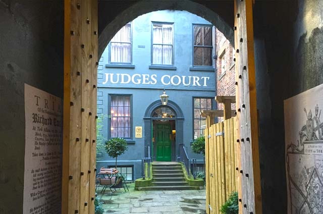
This alleyway off Coney Street leads into a courtyard and, beyond, a four-storey Georgian building. Between 1720 and 1806 it provided lodgings to Britain’s most senior judges before they set out to York Castle to pass sentence on serious criminal cases – including one Judge William Chapple, who in 1739 convicted the infamous highwayman Dick Turpin for horse-stealing. The building has since been used as a solicitors’ premises and is now a hotel.
Visitors have reported an odd atmosphere to this alleyway. The ghostly figure of a large black-clad man has been seen here, his wanderings accompanied by a metallic rattling. Years later the bones of a large man were discovered in a disused well near here. The remains of his riding boots were also found, including a broken spur…
Inns Brothers Yard
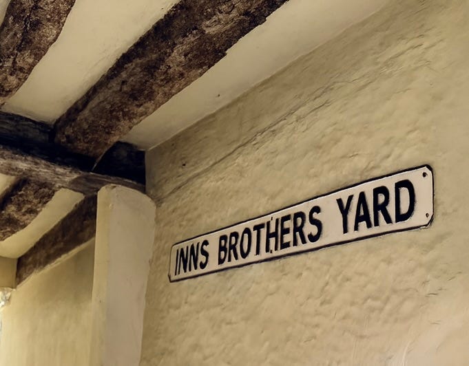
Located at 75 Walmgate, Inns Brothers were cabinet makers, furniture restorers and traders in antiques. The yard leads to workshops.
Hotham’s Court


This is a gated courtyard off George Street, leading to residences and a central tree with a circular bench. The court is likely named after Sir John Hotham (who famously denied King Charles I entry to Hull in the Civil War), with connections to manor houses like Hotham Hall near North Cave.
Hornpot Lane
Like Nether Hornpot Lane, the name of this snickelway relates to York’s horn-making industry. The alley leads to the secluded city-centre church of the Holy Trinity.
Hornby’s Passage
Accessible from Stonegate, this snickelway once lead to a courtyard of shops.
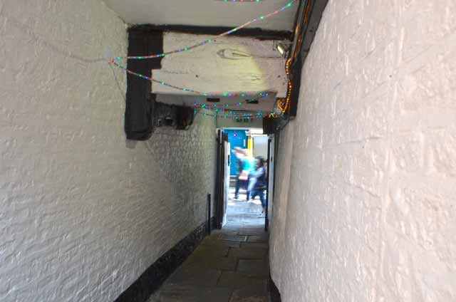
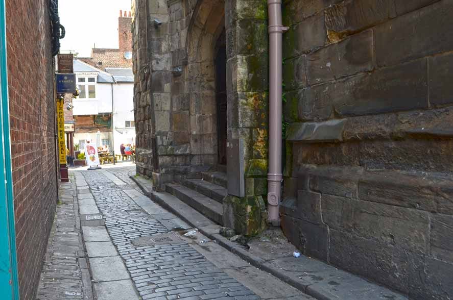
Hole-in-the-Wall
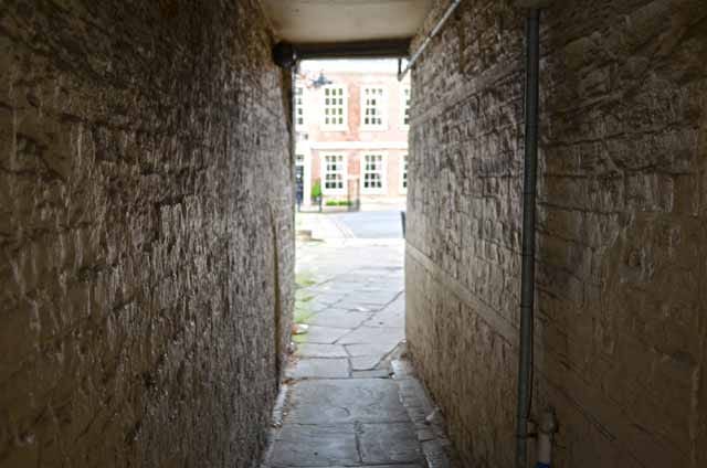
Beside the pub of the same name, this is York’s shortest snickelway. It connects High Petergate to Precentor’s Court, which provides excellent views of the Minster’s west front. Precentor’s Court was developed to separate the commercial properties on High Petergate from the canons’ residences to the rear, a ‘precentor’ being the official responsible for musical elements of worship.
Guildhall Passage
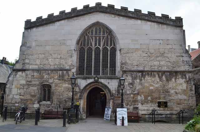
Running under an arch beneath Mansion House – built as a home, and a place for the Lord Mayor to entertain visitors to the city – this alley leads to York’s Guildhall. The current hall dates from the 15th century, built for The Guild of St Christopher and St George. An earlier ‘common hall’ was located here from at least 1256.
Gray’s Court


One of York’s grandest courtyards, it leads to potentially Britain’s oldest continuously occupied house. Gray’s House was commissioned by the first Norman Archbishop of York Thomas of Bayeux (1070 - 1100) as a grand residence for the new role of Treasurer.
Following the reformation the house would go on to house the likes of The Duke of Somerset, General Sir Thomas Fairfax and Archbishops Robert Holgate and Thomas Young. Royalty such as King James Ist, James 2nd and the Duke of Cumberland also stayed.
The sprawling buildings were split up after an 18th-century proprietor, Matthew Robinson, sold the two separate leases to two different owners. At this time, the property was known as the Great House, whereas part of the current Treasurer’s House was known as The Little House. The Great House acquired its current name of Grays Court sometime after 1788 when the Gray family took up residence there and owned the property until the mid-twentieth century.
Friargate
Friargate is today a short street connecting Castlegate to Clifford Street, but it once formed part of Hertergate, which was one of the infamous Water Lanes. The Friary, after which the street is named, was a Franciscan Friary located here from at least the twelfth century. The Water Lanes were plagued with diseases and were the centre of the city’s cholera epidemic in the early 1830s.
Franklin’s Yard
This lane, near the River Foss, opens from Fossgate into a courtyard housing a number of small York businesses.
Foundry Yard


Foundry Yard lies off Walmgate, opposite St Denis Road. It provides a pedestrian route to Dixon Yard, which nowadays consists of modern residential developments. Dixon Yard was the location of Walker’s Foundry, established by John Walker in 1837, who manufactured the gates for Kew Gardens and was appointed iron founder to Queen Victoria. In 1850 Walker received his most famous commission: the gates and railings of the British Museum.
Finkle Street
Possibly derived from the Germanic word ‘winkel’ meaning corner, it runs parallel to Nether Hornpot Lane. Alternatively, the name relates to the Old Norse word for ‘elbow’ or ‘bend’ and was once used as a route for livestock, leading to its 18th-century nickname ‘Mucky Pig Lane’. The street’s name has been in use since at least the 14th century, and it was historically an important passage connecting the weekly Thursday market at St. Sampson’s Square to the pig market at Swinegate
‘Falcon Inn snickelway’
While acess to the Falcon Inn on Micklegate was always possible from Toft Green, this snickelway is a modern development by virtue of a row of new holiday lets, which form a narrow snicket running from the pub.
Dixon Lane
Dixon Lane, a narrow thoroughfare where the road is no wider than the pavement, connects Picadilly with George Street. Excavations in 2005-6 uncovered the remains of activity or occupation of Roman, Anglian, Anglo-Scandinavian and medieval date, including a medieval cemetery for St Stephen‘s Church.
‘Dewsbury Terrace back lane’
Back lanes, cobbled with so-called rosemary setts, stable paviours, or stable pavers, or slag paviours (made by the Tees Scoriae Brick Company) are part of the Victorian residential street plan in York, and are numerous. This back lane, running alongside St Columba’s United Reformed Church, is included in the snickelway list because it lies within the city walls, and is a genuine thoroughfare linking one side of Dewsbury Terrace with the other.
Dennis Street
Similar to Barker Lane in width, Dennis St is a short, narrow street following the curtilege of St Denis church, where its timber hall can be found, and connecting Walmgate with St Denis Road.
‘Coppergate Walk’
This relatively new long-ish partially-covered walkway runs beside the River Foss and connects Castle car park with Picadilly, as well as providing side-access to the Coppergate Centre. Opened in 1984, the Coppergate Centre is located on the site of the Cravens confectionery factory and, prior to its construction, archaeology unearthed 40,000 items, largely from Viking-era york. However, the Anglo-Saxon ‘York Helmet’ - now housed at the Yorkshire Museum - is probably the best-known find. It dates to the second half of the 8th century and is is stylistically Northumbrian.
‘Coney Street snickelway’
A narrow unnamed snickelway runs from the precinct containing the Picturehouse cinema and various bars to Coney Street.
Coffee Yard


Linking Swinegate with Stonegate, this is York’s longest snickelway – nearly 220ft. The reconstructed Medieval House – Barley Hall – is located on this snickelway. Originally called Langton Lane in the 1600s it was known for its booksellers and printers. By the early 1700s, the name changed to Coffee Yard to reflect the rise of coffee houses in the area, including the Saracen’s Head which was located on the adjacent Stonegate.
Church Lane
This alley, connecting Bridge Street with Spurriergate, runs along the back of St Michael’s church and opens into a courtyard.
Chapter House Street
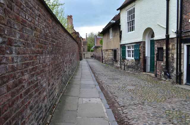
This ancient cobbled street begins at Minster Yard and passes the Treasurer’s House and Grays Court, before bearing right to connect with Goodramgate. It follows the route of a Roman road and was once part of the 13th century Minster Close.
‘Castlegate House snickelway’


A snicket runs downhill between Castlegate House and 28 Castlegate, and originally may have provided access to Clifford Street (it is now gated.) A further snicket runs at a right-angle, below street level directly along the front of Castlegate House. It is a significant Georgian townhouse designed by John Carr for Peter Johnson, the City Recorder, around 1762-63 on land from the Franciscan Friary. The house has also served as a Quaker school, and most recently as a Masonic Lodge.
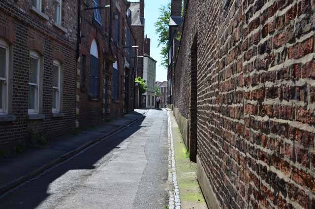
Carr’s Lane
Formerly known as Le Kirke Lane or Kirkgail, it is a cobbled way just outside the city centre, rising steeply from the River Ouse to the site an ancient church. St Mary’s church at Bishophill Senior may have been the location of York’s first minster, making Carr’s Lane an ancient and significant routeway.
Breary’s Court
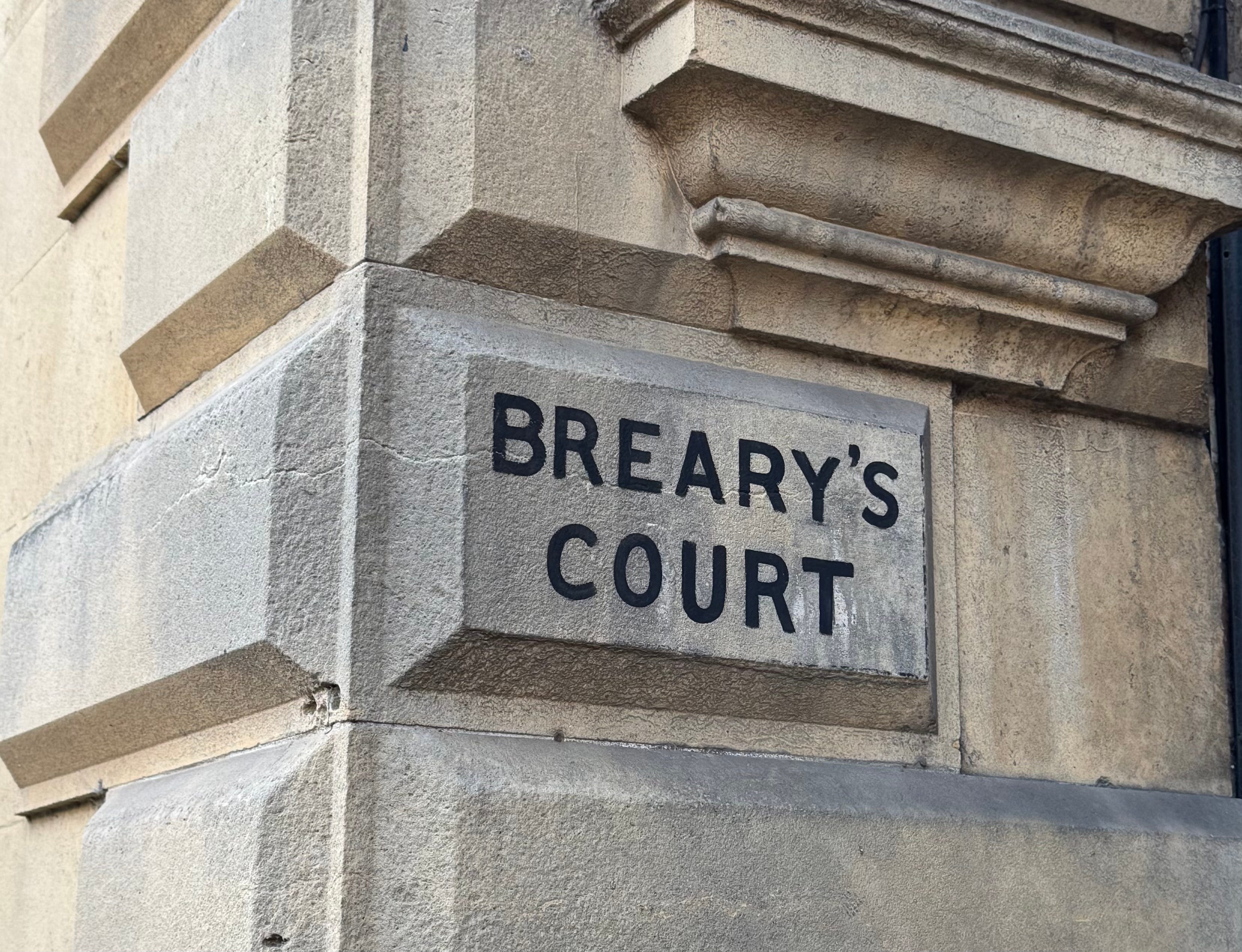
Located between the Yorkshire Insurance Company building and Joseph Terry House on St Helen’s Square, it is accessed by an entry arch and originally provided a route through to the latter building.
Black Horse Passage
With Straker’s Passage it connects Stonebow to Fossgate. It has a history linked to the medieval Carmelite Friary, which used part of the area for its grounds, and later became a notorious area for poverty and crime in the 19th century. The passage was a hub for prostitution and other illicit activities. In 1855 it was revealed that one Inspector Turner, in charge of the night shift in York’s police force, leased several houses of ill repute in this area and lived off their earnings.
Bedern
An ancient lane, off Goodramgate, leading to Bedern Chapel and Hall and, via Bartle Garth, to St Saviourgate. A bridge, now destroyed, would have connected Bedern to the Minster precinct.
The word ‘bedern’, meaning college or house of prayer, is Anglo-Saxon. The street name derives from Bedern Hall.
In the 19th century this area of York was a slum. A tale with dubious provenance tells of an unscrupulous character by the name of Pimm, who ran a school and workhouse here for poor and orphaned children. He neglected their needs so badly that they died in large numbers. Pimm buried a few but stored others in cupboards within his school. But the restless dead children haunted Pimm, and drove him to drink and madness. The children can still be seen and heard today; their shadows have been seen on walls, invisible hands and breath felt, giggles and screaming heard.
Barleycorn Yard
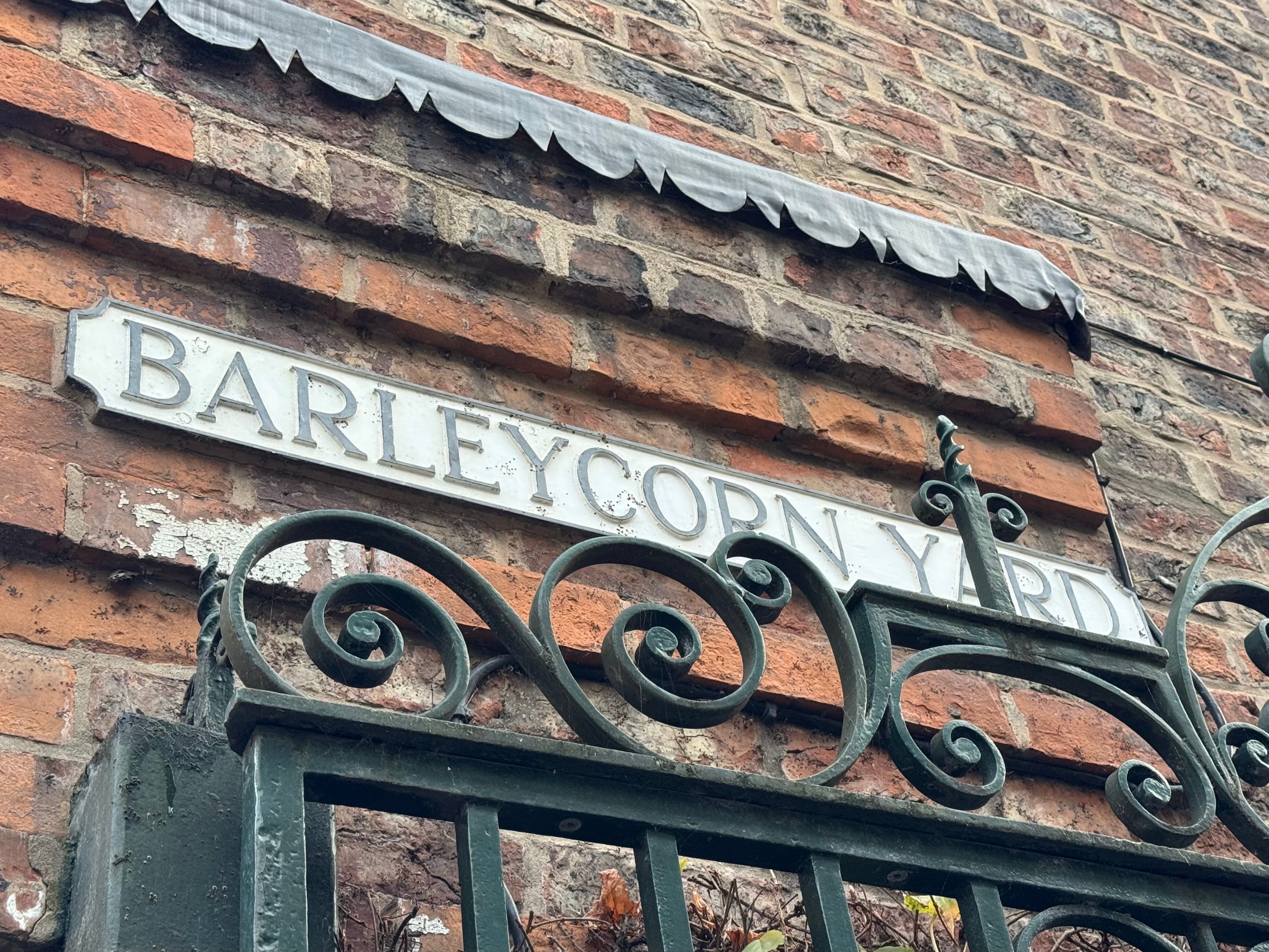
A relatively recent redevelopment, this enclosed courtyard on Walmgate houses residences, offices and retail space.
Barker Lane
An ancient Lane, wide enough to now be navigable by car (just.) It connects Toft Green with Micklegate. It sits on a Roman road and was formerly the site of a medieval church, St. Gregory’s.
Ayre’s Yard
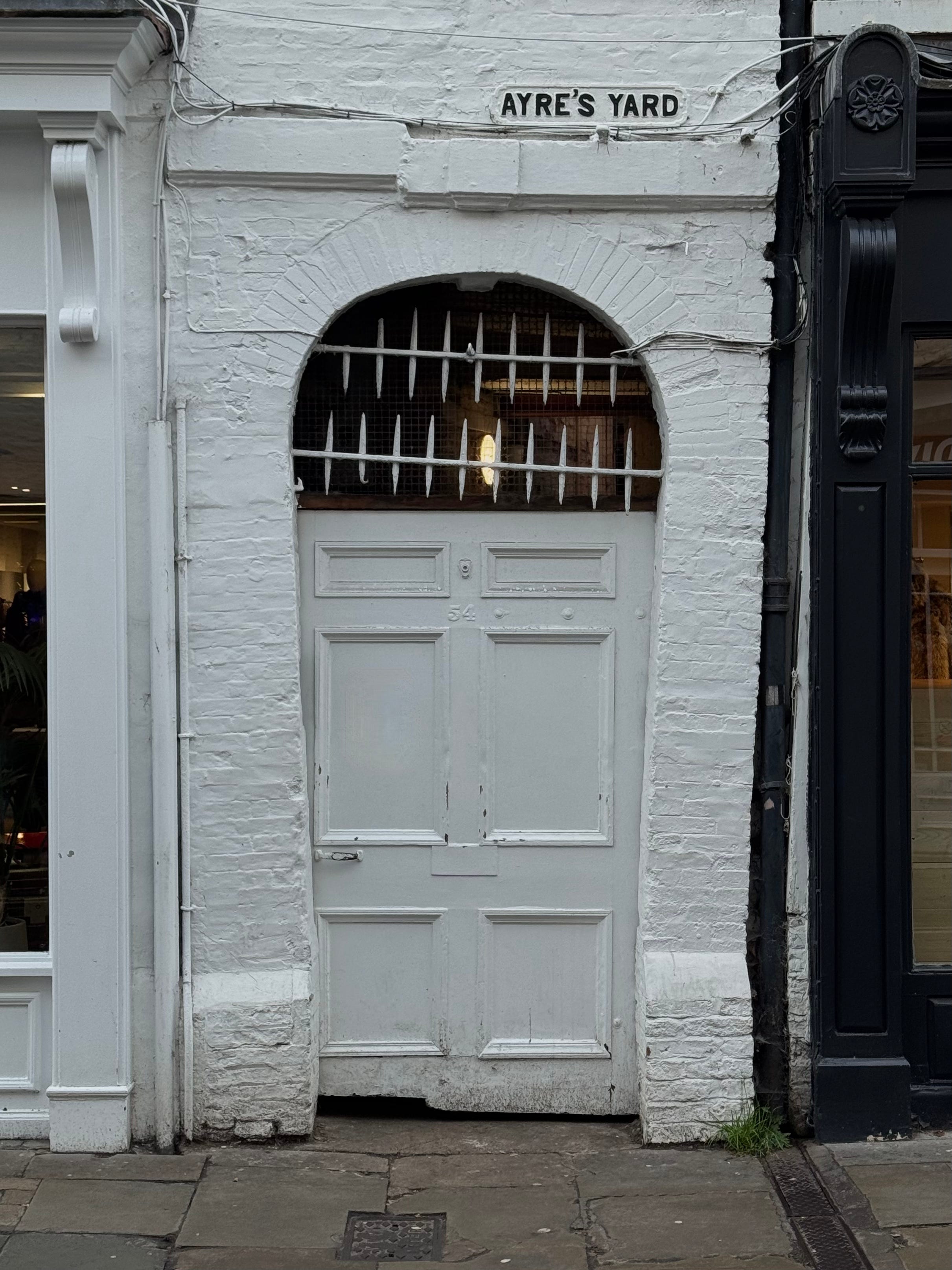
This round-arched brick opening provided access to what was once a three-storey house at 95 Petergate. Coroners’ records record the death of one Elizabeth Hayter, aged 78, at Ayre’s Yard in 1914.
‘Art Gallery alley’
An alley, made accessible in 2015, runs between York Art Gallery and the walls of St Mary’s Abbey, providing a thoroughfare between Exhibition Square and the ‘Edible Wood’ in Museum Gardens.
53 Low Petergate
Often locked, the door of 53 Low Petergate leads through a snicket to a courtyard onto which No.7 Grape Lane backs - originally a 17th century printing works.
52 Goodramgate
This is covered alleyway leading to private residences and businesses. An interesting kangaroo frieze can be seen near the entrance.
35 Stonegate
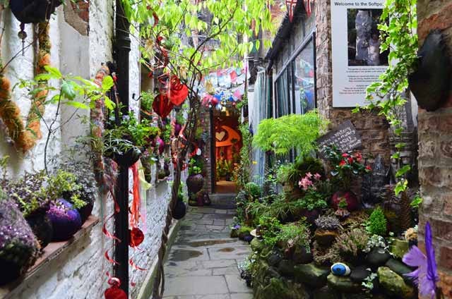
Previously a lovely snickelway-cum-garden showcasing Annie’s ‘softpots’ – fabric plant pots, the snickelway has more recently been part of a haunted house experience and a retail outlet.
29 Castlegate
A snicket runs between 29 & 31 Castlegate, leading to Castle Walk. The former, a Grade II listed building with origins in the 1840s, was constructed as a house alongside other significant Georgian developments on Castlegate, including mansions such as Fairfax House and Castlegate House. In the 20th century the building housed a young people’s centre before becoming vacant and semi-derelict. It was recently renovated and now serves as offices.
23 Stonegate
This fine pillar-lined alley leads to the premises of the York Medical Society. The property is mainly Elizabethan, constructed in about 1590, and originally built as two or even three houses. It is one of the larger timber-framed houses to have survived in York but is now almost completely hidden from view, despite containing a pleasant walled garden. In the eighteenth century, there were many changes; rooms were divided and a fine Georgian staircase added. A library was added in 1804 and a further major addition to the house - the tall west wing - was added in 1870. In the 70s it was completely restored and renovated.
10 Low Ousegate


Low Ousegate is a medieval street and, although redeveloped in the early 19th century, the long narrow plots of No 10 still reference plot boundaries typical of the medieval period. Now the premises of O’Neill’s Irish pub, 10 Ousegate was a 19th century house and shop. One alley runs from Low Ousegate to a small courtyard at the side of the premises, while another connects the same courtyard to Church Lane, which passes behind the Spurriergate Centre.
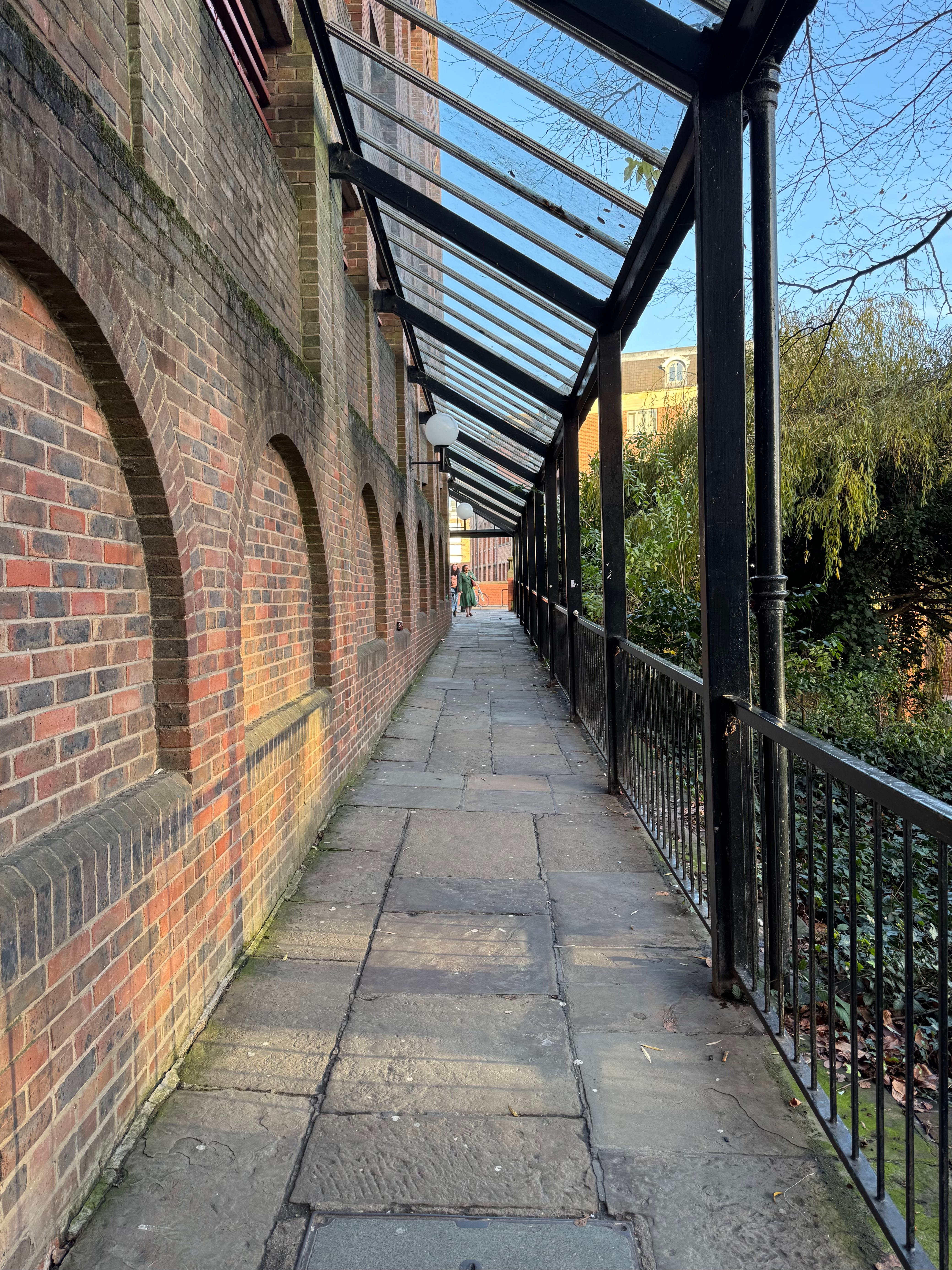
The main focus is on snickelways inside the city walls (only one is outside the walls in the above list), although many more lie without.
There are dozens of courts and yards in York. Most are little more than storage spaces for bins. On this basis only named courtyards or those with some notable feature are included. A full list is available here, many now lost, including Artichoke Yard, Micklegate, Trout’s Passage, Walmgate and Whitwell’s Entry, Colliergate.